
मेरो नेपाल महान My Nepal Great
Nepal is a landlocked country in South Asia lying on the southern side
of the Himalaya mountain range, bordered by China and India. Nepal is
about 800km long from northwest to southeast and has a total area of
147181 sq. km. Its terrain is mostly mountainous, with only the narrow
southern strip consisting of plains. The mountainous north contains
eight of the world's ten highest mountains, including the highest, Mount
Everest.
The Kathmandu valley has been settled for at least 9000 years. The first
recorded history dates back to 1000 BC, when a number of small kingdoms
and confederations of clans arose in the region. Much of Nepal was
first unified by the late 14th century, although for a short time only.
Nepal was unified again in 1768 and maintained its independence even
when the British colonized India. In 2008 Nepal became a parliamentary
republic. Nepal is an ethnically diverse country with almost 30 million
inhabitants and 92 spoken languages. With a GDP per capita of just USD
400 the economy is very underdeveloped. The impressive natural landscape
and the rich cultural heritage of Nepal give it a considerable tourism
potential, but the development in this sector has been hampered by the
years of civil war through which the country went. The capital of Nepal
is Kathmandu.
 |
 |
 |
 |
|
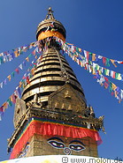
43 photos of Kathmandu, the capital of Nepal
|
|
|
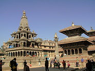
26 photos of Patan, the second largest town in the Kathmandu valley
|
|
|
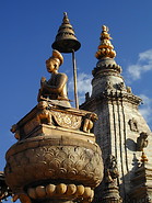
31 photos of Bhaktapur, the most medieval of the three major cities in the Kathmandu valley
|
|
|
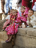
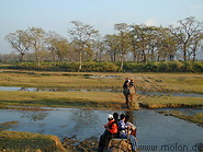
22 photos of a marriage in Bhaktapur, of children in Kathmandu and sceneries in Nepal
|
|
 |
 |
 |
|
21 photos of Pokhara a town on a lake next to the Annapurna mountain range
|
|
|
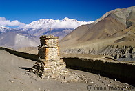
129 photos of the trek around the Annapurna mountain range
|
|
|
24 photos of the Chitwan NP in the Terai region
|
|
|
| Welcome to the Kathmandu photo gallery. Here you'll find Kathmandu
pictures I took in on a trip in December 1999, while visiting my
brother. I spent a total of three or four days in Kathmandu staying in a
guesthouse in the Thamel area - the budget travel area of Kathmandu.
The pictures you see here are of the main attractions of Kathmandu:
Swayambhunath, the old town, the temples, the Bodnath stupa and the
Pashupatinath temple area.
Kathmandu is a relatively relaxed town, if compared to Indian towns,
meaning that it is reasonably comfortable to stay there for a few days.
The air however was very polluted during my stay in December 1999. | Kathmandu click |
|
| This gallery contains photos of a marriage in Bhaktapur, of children in
Kathmandu, Bhaktapur and Chitwan and some images of what Kathmandu looks
like at night. In picture 2 a fire of plastic is burning - you'll
understand why the air in Kathmandu is so polluted. %Rice is apparently a
major crop in Nepal and is cultivated in rice terraces (see the rice
terrace pictures). You'll also find some sunrise pictures taken in
Nagarkot. | Nepali People and Landscapes click |
|
| Pokhara is renowned for its setting rather than its historical or
cultural endowments. Its peaceful lakeside location and proximity to the
Annapurna mountain range mean it is an ideal place for recovering from
(or gearing up for) a trek. Treks can be organised here as there is a
good supply of guides and porters. Personally I just made it to
Sarangkot (1592m) planning to take some Himalaya pictures. However the
air wasn't clear as December lies in Nepal's dry season. The panorama
pictures of the Annapurna range were taken from a boat in Pokhara lake. | Pokhara and Annapurna Range click |
|
|
Welcome to the Annapurna trek photo gallery! This is a photographic
record of a 12 days trip by Markus Molon around the Annapurna range
along the Annapurna trek, starting in Besisahar and ending in Nayapul
near Pokhara, passing through Tal, the Manang valley, Manang, Thorung
Phedi, the Thorung La pass, Muktinath, Kagbeni, Jomson and Tatopani.
You'll find detailed descriptions of the Annapurna circuit in each of
the below galleries.
| The Annapurna crek |
|
| Patan is separated from Kathmandu only by the Bagmati River and is the
second largest town in the valley. It is also known as Lalitpur, which
means city of beauty. The pictures you see here are of the main
attractions of Patan: the old town, the temples and Durbar square. | Patan click |
|
|
|
|
|
| हेरिदुनु भएकोमा धन्यवाद ! Thanks for visiting this sites. |
|
|
|
|
|
|
|
|


